WMO warns of a potentially historic El Niño
The World Meteorological Organization says the strengthening El Niño could be the strongest in more than 70 years and persist until at least February 2027.[2][4] Forecasts indicate that monthly sea-surface temperatures in the central and eastern tropical Pacific could approach 4C above average, whi…
Open original (3 sources):
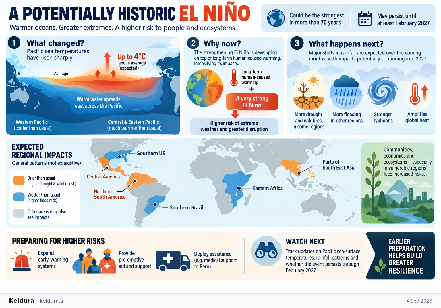
The World Meteorological Organization says the strengthening El Niño could be the strongest in more than 70 years and persist until at least February 2027.[2][4] Forecasts indicate that monthly sea-surface temperatures in the central and eastern tropical Pacific could approach 4C above average, while the event amplifies heat, drought, wildfire, typhoon and flood risks across different regions.[2][4]
Why it matters: El Niño is developing on top of long-term human-caused warming, potentially intensifying disruption to communities, economies and ecosystems; vulnerable regions already face wildfires, deadly typhoons, evacuations and heightened flood risks.[2][4]
Key insights: WIRED describes the WMO outlook as the most certain forecast in the organization's history.[3] | Drier-than-usual conditions are forecast across much of South East Asia, Central America and northern South America, increasing drought and wildfire risks.[2][4] | Wetter conditions are expected in parts of eastern Africa, southern Brazil and the southern US, raising flood risks.[2][4] | Governments and aid groups are expanding early-warning systems and pre-emptive assistance, including a US medical-support deployment to Peru.[2][4]
Cheatsheet facts: What changed: Pacific sea temperatures have risen sharply, putting El Niño on course to become an exceptionally strong event.[2][4] | Why now: The WMO expects major rainfall shifts over the coming months, with impacts potentially continuing into 2027.[2][4] | Watch next: Track WMO updates on Pacific sea-surface temperature anomalies, rainfall patterns and whether the event persists through February 2027.[2][4]